Advanced Technological Systems, Inc. (ATS), was formed specifically to provide a less expensive alternative to subsurface utility location. While maintaining a low overhead, ATS can provide subsurface utility engineering services at very competitive rates.
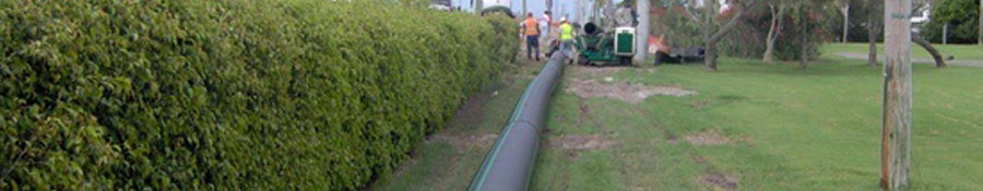
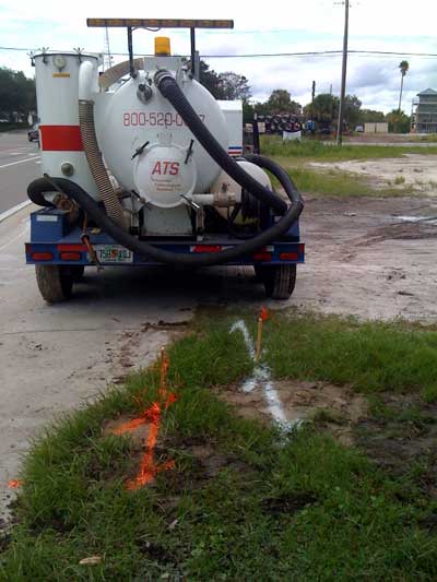
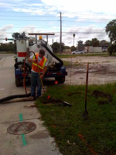
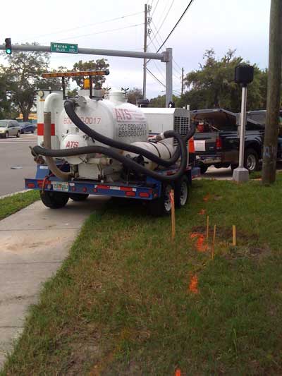
Staffed by professionals with both utility designating/ locating and design experience, ATS can perform all facets of subsurface utility engineering (SUE) work. The accurate mapping of existing underground utilities during the project design phase and/or prior to the start of construction, can reduce costly utility conflicts or construction delays associated with poorly marked utilities. Don’t rely on the Sunshine State One-Call marks. The accurate location of underground utilities can only be confirmed by obtaining visual verification. The steps to achieve this verification are:
Utility Designation:
Utilizing electronic locating equipment, the horizontal location of most underground utilities can be delineated and marked. When non-metallic utilities must be located, Ground Penetrating Radar (GPR) equipment is also utilized to precisely locate the subsurface feature. This equipment is especially effective in locating sanitary sewer laterals, PVC water lines or any other “non toneable” utilities prior to the placement of proposed utility lines underground. ATS uses both electromagnetic and GPR equipment to designate underground utilities at low rates
Vacuum Excavation:
Utilizing non-destructive vacuum excavation equipment, the horizontal and vertical location, size, configuration and the material of the underground utility or feature can be determined. This information is retrieved while impacting a very small area that can then be quickly and inexpensively restored. Utilizing a VacMasters 1000 unit, ATS utilizes air pressure to safely excavate the soil over the target utility.
Once the utilities are located, ATS sets reference points to deliniate the location of each utility found. The reference point is either an iron rod and cap if in soft surface or a nail and disk for hard surfaces.
Mapping:
The data collected in the field is then recorded in Field Reports for submission to the Client. ATS will customize the reporting format to meet the Client’s criteria. If desired, the information can be surveyed and then transferred into a digital format using computer aided design (CAD) systems. ATS employees are FDOT certified for setting up Maintenance of Traffic (MOT) plans
|